


chemin des Lombards

rando30129
User
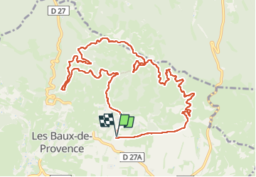

Length
12.9 km

Max alt
304 m

Uphill gradient
332 m
Km-Effort
17.3 km

Min alt
126 m

Downhill gradient
330 m
Boucle
Yes
Creation date :
2024-05-16 06:40:10.785
Updated on :
2024-05-16 10:26:21.082
3h44
Difficulty : Easy

FREE GPS app for hiking
 SityTrail
IGN / Geographical institutes
SityTrail Plus
The world is yours!
About
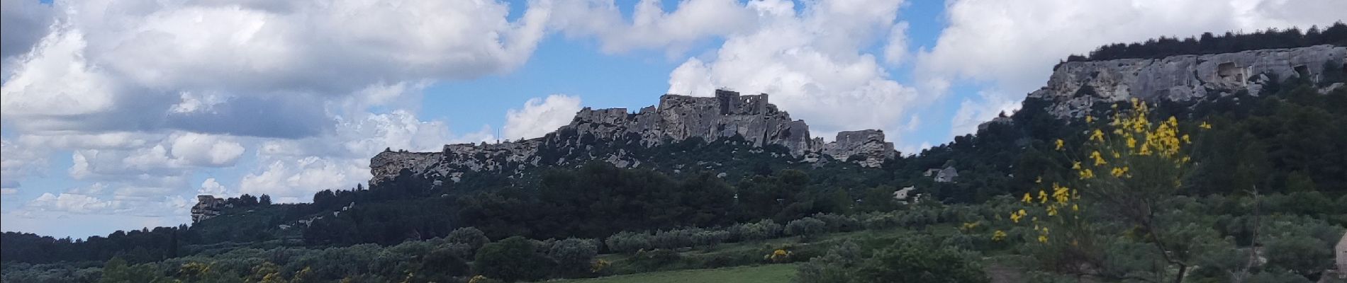
Trail Walking of 12.9 km to be discovered at Provence-Alpes-Côte d'Azur, Bouches-du-Rhône, Les Baux-de-Provence. This trail is proposed by rando30129.
Photos

Positioning
Country:
France
Region :
Provence-Alpes-Côte d'Azur
Department/Province :
Bouches-du-Rhône
Municipality :
Les Baux-de-Provence
Location:
Unknown
Start:(Dec)
Start:(UTM)
645619 ; 4845093 (31T) N.
Comments